photo: Ion David

Chapada dos Veadeiros

The Chapada

Choose what path to take and get ready, your journey will take you to amazing places.

Famously known as the Waters Cradle, the Chapada dos Veadeiros stands out for its amount of crystal clear water springs, waterfalls, canyons, amazing landscapes, historic trails and its hospitable people.

The region is protected by the Chapada dos Veadeiros National Park, which has been honoured as a UNESCO World Heritage Site and Goyas Biosphere Reserve.

In this impressive scenery we develop countless itinerary options, bringing our customers unforgettable experiences.

photo: Ion David

History

First humans to cross this region were the nomadic indigenous tribes of the Avá Canoeiros and Crixás, who came to the mountains for hunting and used to build temporary shelters.

Around 1730, the first Brazilian Colonial Explorers, the Bandeirantes, arrived. They have mined gold from water streams and settled the first local villages. Alongside them, African Natives were brought as slaves. But soon enough, they ran away from the mining camps to the valleys, where hidden communities were established and still remain quite isolated. Forming the Kalunga Community, living in the north portion of Cavalcante County.

The founding of Mr. Francisco de Almeida’s Veadeiros Farm, in 1750, became an important factor for the future of colonization, but nothing remarkable actually happened in this bucolic scenery from the decline of the gold mining era (1780) until the end of the Nineteenth Century.

Only in 1892, significant transformations in the geographic, political and social life of Brazil’s central region came about. The creation of the Comissão Exploradora do Planalto Central (Central Mesa Exploration Commission), led by Luiz Cruls and constituted by scientists, technicians and military staff, focused on demarcating the area for the future Brazilian District Capital. Expeditions occurred and the limits of the Capital land were set, but the Capital remained the same up until 1960, when Brasilia was founded. The brand-new Federal Capital, made the whole region prosper and start to reflect the deep changes produced by it.

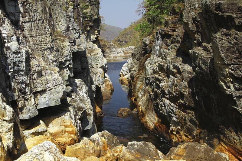
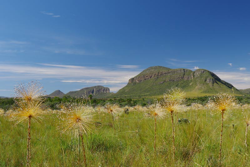
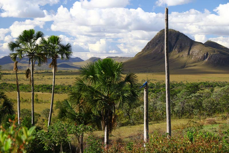
A year after the Capital was founded – 1961 – President Juscelino Kubitschek created the Chapada dos Veadeiros National Park, first called Tocantins National Park, which encompassed a huge piece of Brazil’s central region and all its natural beauty.

In 1980 two important projects changed the region to its current feature: The Alto Paraiso and Rumo ao Sol Projects. The first was a government project looking to develop tourism in the region, by laying urban facilities such as hotels, airport, roads, and fruit production, creating a regional development pole in the State of Goias’ northeast. The second one, led by a group of enthusiasts, focused on developing alternative communities, based on holistic and mystic concepts. For the first time in history, a fairly large number of settlers were attracted to the region coming from all over the country.

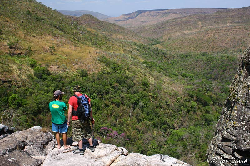
The development of eco-tourism as an economic activity came as a later event. So, from the time of first explorers to current days, Chapada dos Veadeiros and its Communities have since experimented with many political, social and economic changes.

photo: Ion David

Geography

Located on the highest part of the Brazilian Central Plateau, Chapada dos Veadeiros is a 4.492 square-kilometer mesa that encompasses 5 municipalities. Geologically, it is the oldest part of the continent.

It is formed by mountain ranges, hills, fields, flatlands, grasslands, tablelands, moorlands, meadows, pastures and valleys. It holds some of the last, and biggest, sources of unpolluted river waters on the planet.

The beauty of its landscape, embellished with waterfalls, sparkling natural swimming pools, amazing canyons and fantastic gorges (some of them towering 700m high), make this site an ideal place for traveling, hiking, rappel, camping, cascading and many other outdoor activities.

Geografia da Chapada dos Veadeiros
Image gallery

Geology

The Chapada dos Veadeiros region, National Park included, is one of the oldest geomorphological facets of the Central Plateau. It is an important convergence area for the Supergroup Veadeiros – a set of huge geological formation plates. These groups range from 650 million years to 2.1 billion years old. All of which formed in the Precambrian Era, before life appeared on the Earth, the reason why we can’t find any fossils around the Chapada.

The tectonic encounter of these groups is what makes the region’s geology so exceptional. Over time, its landscape has been shaped by all kinds of severe weather conditions and natural effects, forming valleys, canyons and waterfalls.

All this movement grants us with formidable landscape diversity, which is the basis for its singular biodiversity. Geological and ecological processes, in association with the altitude variation, contribute to the existence of so many attractions, recreation sites and close touch with Nature.

Text: Joana Sanches – UFG

foto: Ion David

Fauna

Cerrado brings a great variety of species in all of its environments, which have lots of ecological resources at their disposal. Housing abundant communities, with lots of individuals, in many cases with specialty adaptations to explore this habitat.

To have a measure, 50 from a total of 100 Brazilian mammal species live in the Cerrado. Another 830 birds of all sizes; 150 amphibians (45 endemic); 120 reptiles (45 endemic); 90 species of termites; 1000 butterfly types; and 500 bees and wasps.

Due to man-made interventions, the Cerrado has gone through massive modifications in various habitats. Consequently, bringing lots of species into the verge of extinction.

Some of the species we find at the Chapada dos Veadeiros

Araras (Macaw)

Very colorful parrot-like birds, belonging to the Psittacidae family. Due to a high demand in making them pets, these birds have been in a threatened conservation status. Disappearing from its original habitats.

Tamandua-Bandeira (Anteater)

The Anteater (Myrmecophaga Tridactyla) is commonly found in the Central and South Americas. Mammal from the Myrmecophagids family.
An adult can weigh up to 40kg and reach 1.8m long. Presenting grey-to-brown colors, with a black stripe starting in the chest, and stretching to the back. Long furry tail, long round nose, three claws on the back foot and five on the front ones.

Feeds himself of ants and termites, all captured by its very long and adherent tongue.

Anta (Tapir)

The Tapir is the biggest mammal of South America. Though it is much smaller than its African and Asian relatives. Theories search for an explanation to its size, relying on the hypothesis of the Americas getting too dry after the last Ice Age to house big animals.
It may reach up to 300kg. It has a flexible trunk and lives close to humid forests and rivers. It usually bathes to get rid of all sorts of parasites.

Herbivore. It can even be seen eating in plantations, since it spends an average of 10 hours a day searching for food.

Solitary and of night habits, it’s rarely seen with a companion, unless to mate and feed the offspring.

When in danger, it dives into the water with good swimming ability, or hides in the forests taking small trees down when galloping away.

Lobo-Guara (Guara Wolf)

This wolf is the biggest canine South America-native. Its geographical distribution extends throughout Brasil, Paraguai, Peru, Bolivia, East of the Andes. Extinct in Uruguay and possibly Argentina.

Brazil holds the largest population with about 22-thousand of a total of 25-thousand individuals left. It has been seen in every Brazilian biome, except in the Amazon.

This species is not directly connected to any other canine, making it an apparent relic of South American Pleistocene fauna that disappeared after the Isthmus of Panama formation.

Onca-Pintada (Jaguar)

The Jaguar is a carnivore mammal, found in the warm-to-tempered regions of the American Continent. Ranging from the South of the United States all the way to the North of Argentina. It is a Brazilian Fauna symbol.

The term ‘Jaguar’ originates in indigenous Guarani word “Yaguarete”, which means The True Jaguar. In Mayan Mythology, even though it is a sacred animal, it used to be hunted in ceremonies for the initiation of Warriors.

Pato-Mergulhão (Diving Duck)

The Cerrado Diving Duck is a fine holder of a long fern ridge on top of its head. Making it very unique. Head and neck are black with the rest of the body showing tones of grey. They feed on fish, small snails and insects.

Reproduction sites are usually shallow and rapid water streams. They nest in tree holes and eventually in rocks too.

This species is in a critical extinction process due to deforestation and water pollution brought by big farming, with its population estimated at 250 individuals only.

photo: Ion David

Flora

Even not totally known, Cerrado’s flora is very rich. It is the second largest Brazilian vegetation, covering 20% of the territory. From grassy fields to dense forests, it presents a well diverse vegetation overall.

Recognized for being the most biodiverse savanna in the world with many ecosystems, it has more than 10,000 plant species, with more than 4,000 being exclusive from this biome.

Grasslands cover most of this territory. It is essentially covered by different grass types and small trees and bushes, divided in two groups: Cerrado Fields and Clean Fields. They differ by its terrain, soil compositions and elevations.

The tallest trees of the Cerrado may grow as high as 15m tall in irregular structures. Only in places close to water, they may reach up to 25m high and usually have small leaves. In the sandy plateaus and warm rocky fields we find the most exuberant and exotic cacti, bromeliads, and orchids, with hundreds of endemic species. Not to mention unknown species that, before even being discovered, may be destroyed by men.

Image gallery
photo: Ion David

Chapada dos Veadeiros National Park

Created on January 11th, 1961, by President Juscelino Kubitschek, the Chapada dos Veadeiros National Park first received the name of Tocantins National Park for its magnitude of State-like dimensions. Protecting an original area of 625 thousand hectares (approx. 1.55 million acres), it has suffered two drastic reductions in the 70’s and 80’s, now lasting only 10% of its original stature.

Chapada dos Veadeiros National Park has in its protected area a large amount of what still lasts as the intact flora and native fauna, with endemic species only found in the Altitude Cerrado ecosystem. It also protects the Rio Preto influenced area. This river is the natural divisor of Alto Paraiso and Cavalcante counties and forms many canyons and waterfalls, such as: Canyons 1 and 2; Cariocas, Garimpão – also known as Saltos 1, and Saltos 2 Waterfalls. The Saltos complex forms one of the most amazing and photographed landscapes of Brazil’s natural beauty, holding impressive heights of 80m at Saltos 1, and 120m at Saltos 2.

In the early 90’s, IBAMA (Brazilian Environment Institute) and the local community fixed a visitation system that became a national model. Local tour guides were trained and visitors could rely on local expertise while in the National Park. By doing that, resources are directly generated to the local community, who naturally cares for the maintenance of the conservation unity. Nowadays, two local guides associations, ACVCV and SERVITUR, organize the category and maintain the partnership with IBAMA in accordance with its guidelines, as well as the guides’ recycling and trainee programs.

Image gallery
Receive news about Travessia Ecoturismo in your e-mail